The “Incident County” column is showing up blank, even when the data field is complete in the system. Any suggestion on why this is happening? This is verified as an issue in Jordan and Tanzania.
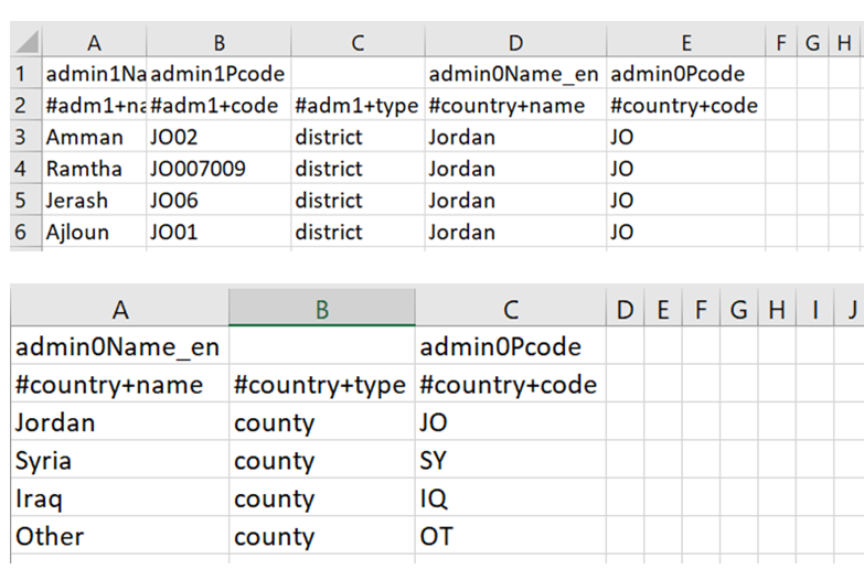
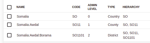
Make sure that the TYPE is set to county on the locations (even if Awdal in the example below is called something other than a County in Somalia). If types are different from the Country, County and District shown below it will not appear in the IR
1 Like
To update on this as it might be causing some confusion. It is not currently possible to edit the TYPE within the UI (this might be a nice feature to have in the future though). This means that the way to change it is using the import function for locations. Using this a specially crafted csv file can be uploaded with metadata from the Humanitarian Data Exchange to specify the TYPE.
Here is an example from South Sudan

If you are trying to do this on a production instance it is best to disable all the current locations, then import the csv and enable the newly imported locations. Another option which we always use is to remove the existing locations using the command line and the import again using the UI
Thanks! When exporting the IR for GBVIMS+, the caseworker code is blank. How can I make this export?
If it previously exported but now does not then it looks like a bug
For the csv file, Incident Area (column Q in the incident recorder) is type county and Incident Sub-Area (column R in the incident recorder) is type district. Whatever you want in Q needs to be called county in the upload and whatever you want in R needs to be called district. This can be at multiple levels in the geography. Calling things they are actually not means Primero can handle the lack of standardization of the IR at field level. The below location files are what we used for the final location import: