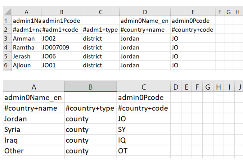
For the csv file, Incident Area (column Q in the incident recorder) is type county and Incident Sub-Area (column R in the incident recorder) is type district. Whatever you want in Q needs to be called county in the upload and whatever you want in R needs to be called district. This can be at multiple levels in the geography. Calling things they are actually not means Primero can handle the lack of standardization of the IR at field level. The below location files are what we used for the final location import: